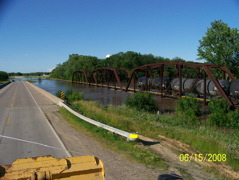
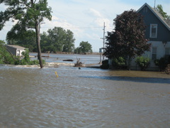
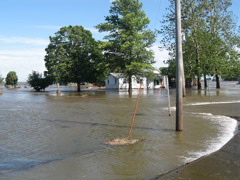
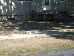
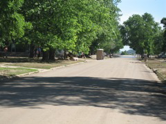
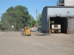
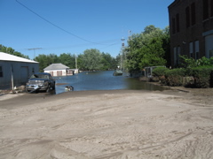
I have been asked by viewers of my site to post some photos of the RR bridge collapse North of Columbus Jct. along Hwy 70 going to Tyson. This is a North spur line off the IC& E RR, the line running East and West through CJ. This view shows the bridge intact with several tanker cars on it filled with water to hold the bridge in place.
|
After the Iowa River Flood water receeded somewhat, the newspapers reported that the bridge was inspected by a firm contracted by Tyson Fresh Meats. The actual collapse was not the metal bridge itself. The collapse was the wooden trestle on the North side of the Iowa River which is considered part of the bridge. The engine is hidden by the piller.
|
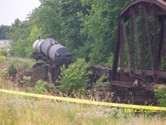
It is hard to view the engine from any angle. It was lying on it's side down in the ditch.
|
Governor Culver's tour of Oakville was a listening tour. He heard from the supervisors, mayors of Oakville and Wapello, levee district members, citizens of Oakville, and our Emergency Management Coordinator. This was not a publicity stunt - at the governor's request, no press were allowed. I am not the press so was allowed to take photos.
|
 |
 |
 |
 |
|
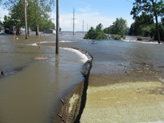
Collapsed RR Bridge North of CJ. Yellow hose is temporary water supply line from Tyson to CJ.
|
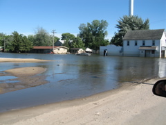
Tankers on track and engine in ditch to right behind pillar. Looking North along Hwy 70.
|
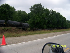
View looking SE along Hwy 70 North of CJ.
|
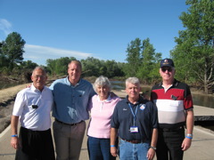
Myself (Louisa County Supervisor Ken Purdy), Governor Culver, Mayor Benita Grooms of Oakville, Tom Colthurst Emergency Management Coordinator, and fellow Supervisor David Wilson with G62 (road to Lake Odesssa) in the back ground.
|
|
|
 |
 |
 |
 |
|
|
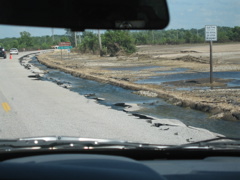
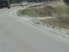
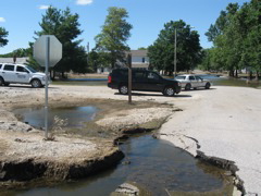
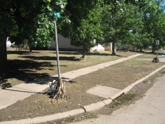
Headed East to Oakville on Hwy 99 East of Wapello. Note the traffic cone ahead. The road narrowed because of washouts on both sides of the road. Governors Culver listend to our plea to encourage the Iowa Dept. of Transportation to assist us in road repair.
|
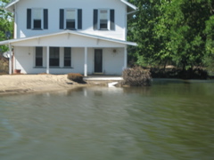
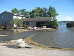
Don and Tanya Purdy's (no relation) residence East of Wapello. Notice the new sand bar in front of the house.
|
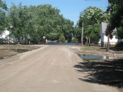
Looking East on Hwy 99 going to Oakville.
|
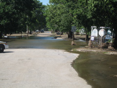
Looking West from the curve that turns East on Hwy 99 just South of the Oakville Hwy 99 Bridge. The levee break on the on the Iowa River was in the background. Sand in the field in the field in the left background is from the levee break.
|
 |
 |
 |
 |
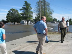
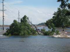
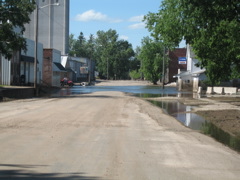
We are on Hwy 99 and the view is to the SE. The white water is going over Hwy 99 after it makes the turn to the South toward Burlington. This water is still flowing. That is a problem unique to Oakville, the governor claims. In other areas, the flood waters have stopped pooring in.
|
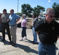
Christy on the left with the incidence response team from Minnesota, Governor Culver, Sheriff Braby. View is to the South on Hwy 99 right at Minnie's convenience store.
|
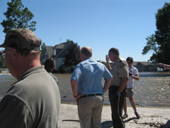
John Carlson, a former residence of Oakville and a columnist for the Des Moines Register, road down from Des Moines with the governor to view the area.
|
Whoops! I am in the foreground to right and the governor and Sheriff Braby in the back ground. I was not able to take a photo of myself talking to the governor. Darn. I asked the governor about assistance for our roads, for assistance for the levee districts, and Oakville's utility needs. The governor had promissing answers.
|
 |
 |
 |
 |
View to South on Hwy 99 with Oakville behind the camera.
|
Sheriff Braby, Governor Culver, Mayor Benita Grooms, official from state level of emergency response, Tom Sand local state represntative.
|
View of Hwy 99 looking to NW at the intersection on the South side of Oakville.
|
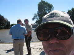
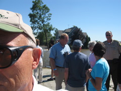
Ken Purdy with ear flapping to left, Gov. Culver, Greg Johnson Louisa County flood plane administrator, Benita Grooms Mayor, Christy of Reponse Team, and Sheriff Braby.
|
 |
 |
 |
 |
Same intersection on Hwy 99 S of Oakville. House is on East side of intersection.
|
Getting ready to Head North into Oakville on City Street. We will drive through water ahead. Lead vehicle Sheriff Braby, Gov Culver's black Yukon, and Louisa County Assessor's vehicle.
|
Looking North into Oakville with entrance sign on right.
|
Last view to South on Hwy 99 by the intersection on the South edge of the city.
|
 |
 |
 |
 |
High water line can be seen on white storm door if you blow up photo by clicking on it.
|
Corn stalks wrapped around signs. Keep in mind there is still standing water on the lower East side of town.This view is looking South on Russell St., main street into Oakville.
|
View looking East from Russell to 2nd Street.
|
Looking North on Russell into Downtown Oakville. See high water mark on tavern/restaurant to right.
|
 |
 |
 |
 |
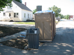
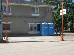
Portable toilets were made available by FEMA
|
FEMA has supplied hand washing stations, bottles of water and portable toilets. The Wapello Ambulance service had an ambulance in Oakville on standy when I was there. Cindy Small was driving. Thank's Small's.
|
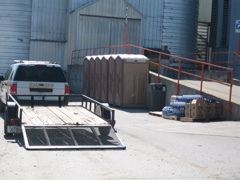
View of toilets lined up at Tri-Oak.
|
Close up of same view.
|
 |
 |
 |
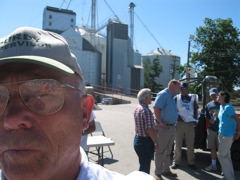 |
View looking to East at Tri-Oak.
|
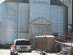
Tri-Oaks office.
|
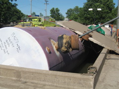
Fuel tanks popped up out of of concrete bunker.
|
Myself, Mayor Durbin of Wapello, Governor Culver, Worker, Greg Johnson and Christy with incident response team from Minnesota.
|
 |
 |
 |
 |
Some from Oakville give me the name of this street please. Truck damage and I assume one of Hewitt's dumpsters in the background.
|
Looking South toward tavern across vacant lot owned by the county. Formerly old Texaco Station.
|
Keith and Bev Kuntz home as we left Oakville going to the West.
|
I took this photo looking to the SE along Hwy 99 as we left Oakville because of the wind driven white caps. Unfortunately the waves don't show up well.
|
 |
 |
 |
 |
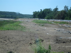
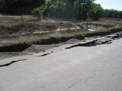
Hwy 99 between Oakville and Wapello. The South side of the road has this kind of damage in many places.
|
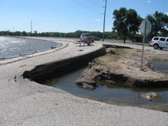
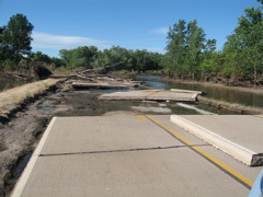
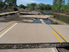
Looking North on G62, the road to Lake Odessa just on the East side of Wapello. This photo and the two photos to the right are the same location. The photos speak for themselves.
|
 |
 |
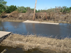
Same location on G62 to Lake Odessa, but looking to East at slab of concrete in the road ditch.
|
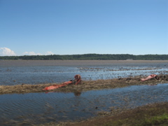
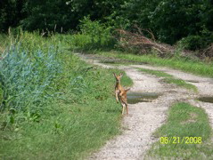
This photo had nothing to do with Oakville but does deal with the flood. We were walking the levee road to my cabin on the Mississippi River and Kim Hafner took this photo of a fawn trying to get to it's mother behind us. This was some of the only high ground in the area.
|
|
|
|
|